
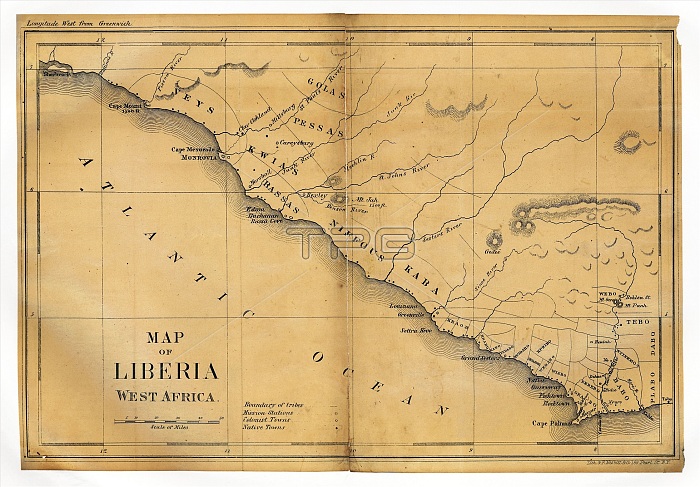
Map of Liberia. 19th-century map of Liberia in West Africa as it appeared in 1830. The first settlement here was by the American Colonization Society in 1822, founded by slaveholders as a colony for free-born American black people. The Republic of Liberia declared independence in 1847, recognised by the USA in 1862. The capital is Monrovia (upper left). This map shows rivers, missionary stations, tribal boundaries, and colonial and indigenous settlements. Tribes named include the Veys, Kwias, Golas, Pessas, Bassas, Niffous and Kaba. The northern and southern borders are at Cape Mount (top left) and the Cavalla River (bottom right).
| px | px | dpi | = | cm | x | cm | = | MB |
Details
Creative#:
TOP16426653
Source:
達志影像
Authorization Type:
RM
Release Information:
須由TPG 完整授權
Model Release:
N/A
Property Release:
N/A
Right to Privacy:
No
Same folder images:
 Loading