
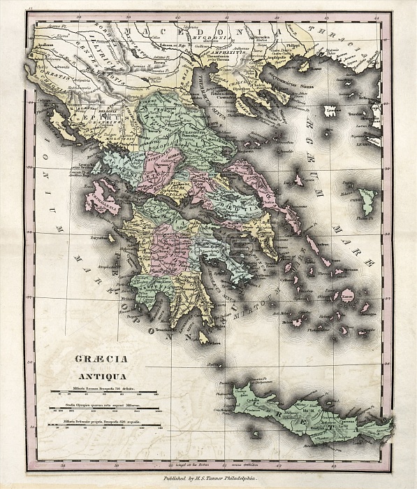
Map of Ancient Greece, 19th century. This map is divided by colour into regions such as Thessaly, Acarnania, Aetolia, Cephalonia, Locris, Phocis, Doris, Boeotia, Euboea, Megaris, Attica, the Peloponnese Peninsula (including Arcadia, Achaia, Elis, Messenia, Laconia, Argolis, Corinthia and Sicyon) and the island of Crete (lower right). Northern regions include Epirus, Macedonia and Thracia. Named seas are the Ionian, Aegean and Myrtoan. The distance scales (lower left) are in Roman miles, Greek stadia, and British miles. Published in 'An Atlas of Ancient Geography' (1826) by US cartographer Henry Schenck Tanner (1786-1858).
| px | px | dpi | = | cm | x | cm | = | MB |
Details
Creative#:
TOP16426056
Source:
達志影像
Authorization Type:
RM
Release Information:
須由TPG 完整授權
Model Release:
N/A
Property Release:
N/A
Right to Privacy:
No
Same folder images:
 Loading