
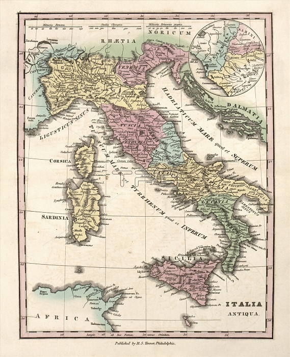
Map of Ancient Italy, 19th century. This map of the Italian Peninsula in the early Roman Empire is divided by colour into regions such as Latium, Apulia, Lucania, Samnium, Picenum, Umbria, Etruria, Liguria and Venetia. In the north is the province of Cisalpine Gaul (yellow, Gallia Cisalpina). The islands of Sardinia, Corsica and Sicily are also shown. The inset map (top right) shows the tribal areas around Rome: Veians (blue), Sabines (pink) and Latins (yellow). The distance scales (across top) are in Roman miles, Greek stadia, and British miles. Published in 'An Atlas of Ancient Geography' (1826) by US cartographer Henry Schenck Tanner (1786-1858).
| px | px | dpi | = | cm | x | cm | = | MB |
Details
Creative#:
TOP16426055
Source:
達志影像
Authorization Type:
RM
Release Information:
須由TPG 完整授權
Model Release:
N/A
Property Release:
N/A
Right to Privacy:
No
Same folder images:
 Loading