
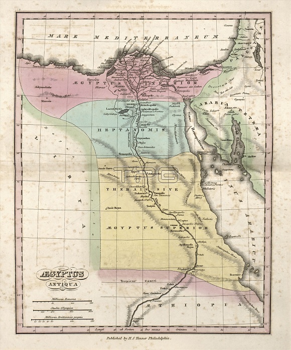
Map of Ancient Egypt, 19th century. This map is divided by colour into regions such as Lower Egypt (Aegyptus Inferior, pink), Middle Egypt (Heptanomis, blue), and Upper Egypt (Aegyptus Superior, yellow). Upper Egypt is also named as Thebaid after the city of Thebes. The regions at upper right (green) are named as Arabia Petraea (Arabia) and Palestinae (Palestine). Regions to the west and south of Egypt are named Libya and Aethiopia (Ethiopia). The distance scales (lower left) are in Roman miles, Greek stadia, and British miles. Published in 'An Atlas of Ancient Geography' (1826) by US cartographer Henry Schenck Tanner (1786-1858).
| px | px | dpi | = | cm | x | cm | = | MB |
Details
Creative#:
TOP16426051
Source:
達志影像
Authorization Type:
RM
Release Information:
須由TPG 完整授權
Model Release:
N/A
Property Release:
N/A
Right to Privacy:
No
Same folder images:
 Loading