
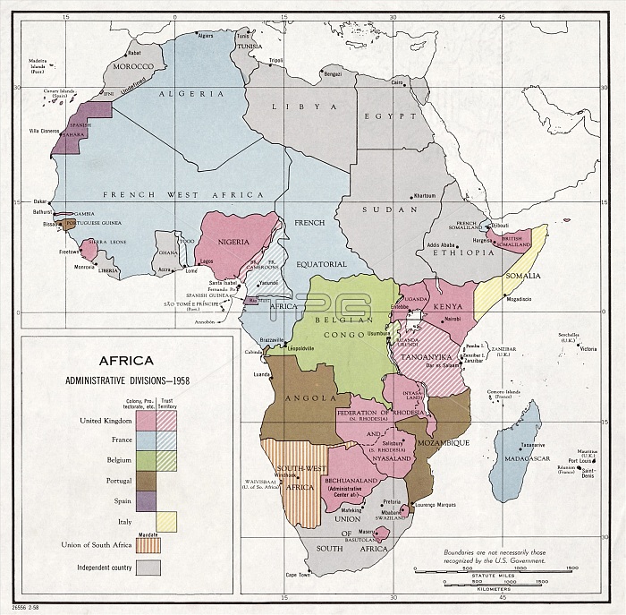
Administrative divisions of Africa. Political map from 1958 showing colonies, protectorates, territories, mandates and independent countries in Africa. European countries that still ruled or controlled large areas of Africa were the UK (pink), France (blue), Belgium (green), Portugal (brown), Spain (purple) and Italy (yellow). Ghana declared independence in 1957. Egypt became a republic in 1953. Morocco became independent in 1955, Libya in 1951, and Sudan and Tunisia in 1956. From 1958 to 1960, a further 25 countries would become independent, followed by a further 26 by 1980. Published in the USA by the Central Intelligence Agency (CIA).
| px | px | dpi | = | cm | x | cm | = | MB |
Details
Creative#:
TOP16313382
Source:
達志影像
Authorization Type:
RM
Release Information:
須由TPG 完整授權
Model Release:
N/A
Property Release:
N/A
Right to Privacy:
No
Same folder images:
 Loading