
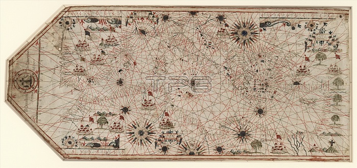
Chart of the Mediterranean. 17th-century chart of the Mediterranean coast and the coast of Portugal and north-west Africa. This is from a portolan atlas (a collection of navigational charts). It was produced either by Italian cartographer Giovanni Battista Cavallini (active 1630-1669), or his son Pietro, or by his workshop. This chart includes 16 wind roses and numerous illustrations including Islamic flags over cities in North Africa and the Middle East, and a depiction of the crucifixion to represent the Holy Land. The lines on the map are rhumb lines, designed to make it easier to steer a straight course. The map dates from 1678 (publication details at left).
| px | px | dpi | = | cm | x | cm | = | MB |
Details
Creative#:
TOP16029001
Source:
達志影像
Authorization Type:
RM
Release Information:
須由TPG 完整授權
Model Release:
N/A
Property Release:
N/A
Right to Privacy:
No
Same folder images:
 Loading