
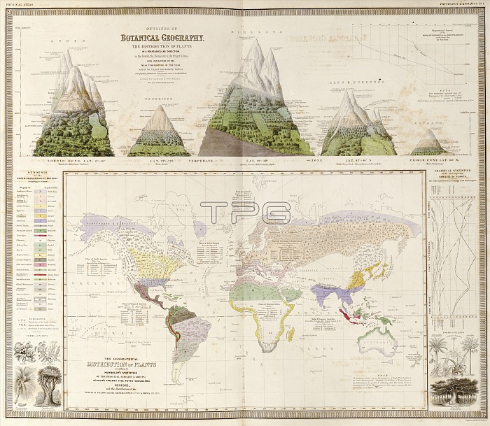
Global botanical geography. 19th-century botanical maps and illustrations depicting the distribution and variation in plant types and habitats worldwide. Across top are the variations on mountains at different latitudes: the Andes, Tenerife, the Himalayas, the Alps and Pyrenees, and Lapland (see C026/8519). The main world map is colour-coded for 25 different regions (key at left). A graph of statistics of plant families is at right. This work, by Scottish geographer Alexander Keith Johnston (1804-1871), was based on work by German geographers Alexander von Humboldt and Heinrich Berghaus. It was published in 'The Physical Atlas' (1848).
| px | px | dpi | = | cm | x | cm | = | MB |
Details
Creative#:
TOP16005521
Source:
達志影像
Authorization Type:
RM
Release Information:
須由TPG 完整授權
Model Release:
N/A
Property Release:
N/A
Right to Privacy:
No
Same folder images:
 Loading