
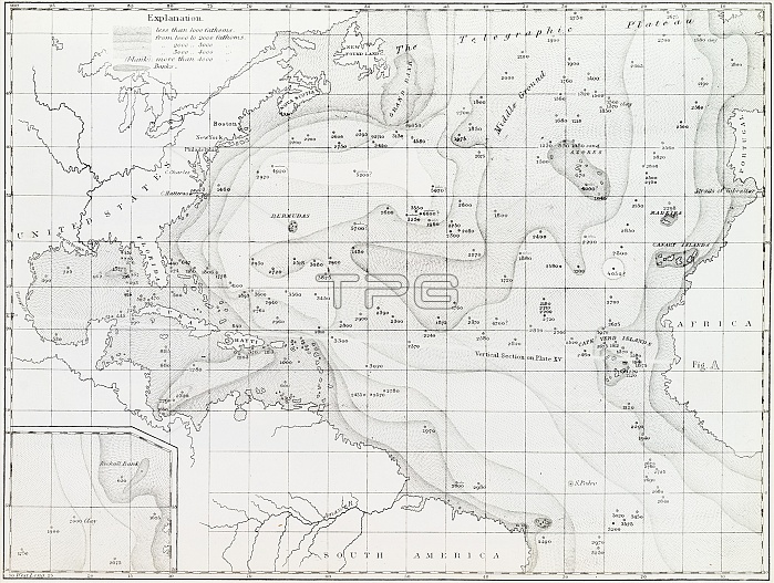
Basin of the North Atlantic Ocean. 1854 edition of the first printed bathymetric map, showing seabed depths in the North Atlantic. The original data was gathered in the 1830s. The maps were produced by US naval officer and oceanographer Matthew Fontaine Maury (1806-1873), first superintendent of the United States Naval Observatory. Depths are shown to 4000 fathoms (7.3 kilometres). An inset (lower left) shows the Rockall Bank off Ireland. 'The Telegraphic Plateau' (top) was later identified as part of the mid-ocean ridge. Map published in Maury's 'Explanations and Sailing Directions to Accompany the Wind and Current Charts' (1854).
| px | px | dpi | = | cm | x | cm | = | MB |
Details
Creative#:
TOP11718749
Source:
達志影像
Authorization Type:
RM
Release Information:
須由TPG 完整授權
Model Release:
NO
Property Release:
NO
Right to Privacy:
No
Same folder images:
 Loading