
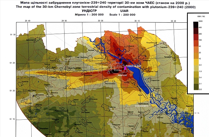
Chernobyl exclusion zone. Map showing the location and contamination density of the exclusion zone set up around the site of the Chernobyl nuclear disaster. The density of plutonium contamination is shown by the colour-coded chart. On 26th April 1986, reactor number 4 of the Chernobyl Nuclear Power Plant went out of control, leading to meltdown and an explosion. Around 1000 square kilometres of land were directly contaminated by radioactive fall-out and a 30km exclusion zone was created. A concrete sarcophagus, the Object Shelter, was built to contain the radioactive materials, but within the restricted area the radiation is still lethal to humans.
| px | px | dpi | = | cm | x | cm | = | MB |
Details
Creative#:
TOP11718401
Source:
達志影像
Authorization Type:
RM
Release Information:
須由TPG 完整授權
Model Release:
NO
Property Release:
NO
Right to Privacy:
No
Same folder images:
 Loading