
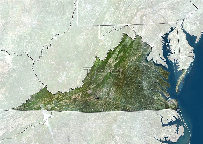
Virginia, USA. North is at top. Natural colour satellite image of the USA, showing the state of Virginia, with the surrounding states shaded out. The Atlantic Ocean (blue) is also shown. The USA consists of 50 states. 48 are situated in southern North America, with the other two being Alaska and Hawaii. Virginia is located in the South Atlantic region of the United States. Image compiled from data acquired by the LANDSAT 5 and 7 satellites, in 2000. Images highlighting all other regions of this country are available. For further information please contact SPL.
| px | px | dpi | = | cm | x | cm | = | MB |
Details
Creative#:
TOP10277465
Source:
達志影像
Authorization Type:
RM
Release Information:
須由TPG 完整授權
Model Release:
NO
Property Release:
NO
Right to Privacy:
No
Same folder images:
200021STCENTURYBIRDSEYEVIEWBIRDS-EYEVIEWBORDERBORDERSBOUNDARIESBOUNDARYCARTOGRAPHYCOASTCOASTALCOASTLINECOUNTRIESCOUNTRYEARTHOBSERVATIONENVIRONMENTENVIRONMENTALFROMABOVEFROMSPACEFRONTIERFRONTIERSGEOGRAPHICALGEOGRAPHYLANDLANDSAT5LANDSAT7MAPMASKEDNATIONNATURALCOLOURNATURENORTHAMERICANORTHAMERICANNORTHEASTERNSATELLITESATELLITEIMAGESTATESTATESTOPOGRAPHICTOPOGRAPHYUNITEDSTATESUSUSAWATERCOASTCOASTALCOASTLINESHORESHORELINESOUTHATLANTICOCEANVIRGINIA
57200021STABOVEAMERICAAMERICANATLANTICBIRDSBIRDS-EYEBORDERBORDERSBOUNDARIESBOUNDARYCARTOGRAPHYCENTURYCOASTCOASTCOASTALCOASTALCOASTLINECOASTLINECOLOURCOUNTRIESCOUNTRYEARTHENVIRONMENTENVIRONMENTALEYEFROMFROMFRONTIERFRONTIERSGEOGRAPHICALGEOGRAPHYIMAGELANDLANDSATLANDSATMAPMASKEDNATIONNATURALNATURENORTHNORTHNORTHEASTERNOBSERVATIONOCEANSATELLITESATELLITESHORESHORELINESOUTHSPACESTATESTATESSTATESTOPOGRAPHICTOPOGRAPHYUNITEDUSUSAVIEWVIEWVIRGINIAWATER
 Loading