
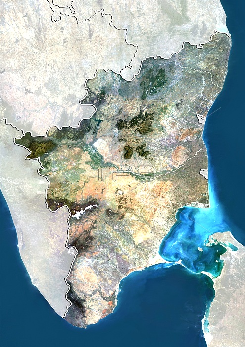
Tamil Nadu, India. North is at top. Natural colour satellite image showing the state of Tamil Nadu, India, with the surrounding states shaded out. India is located in South Asia. Tamil Nadu lies in the southernmost part of the Indian Peninsula and is bordered by the union territory of Pondicherry, and the states of Kerala, Karnataka, and Andhra Pradesh. The Bay of Bengal (blue, right), Gulf of Mannar (blue, bottom right), Palk Strait (light blue, lower right), Indian Ocean (blue, lower left) and Sri Lanka (bottom right) can also be seen. Image compiled from data acquired by the LANDSAT 5 and 7 satellites, in 2000. Images highlighting all other regions of this country are available. For further information please contact SPL.
| px | px | dpi | = | cm | x | cm | = | MB |
Details
Creative#:
TOP10277443
Source:
達志影像
Authorization Type:
RM
Release Information:
須由TPG 完整授權
Model Release:
NO
Property Release:
NO
Right to Privacy:
No
Same folder images:
 Loading