
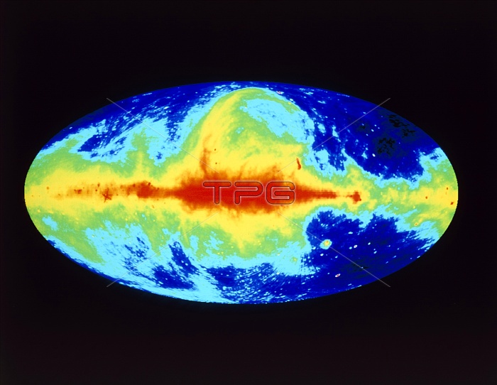
Radio map of whole sky and our Milky Way galaxy. Computer-processed radio map of the whole sky at the 73 cm wavelength. Intensity of radio emission is coded from red (maximum emission) through yellow, green & blue to black. The red horizontal band is the plane of our galaxy. The loop of emission at centre top is the North Polar Spur. The projection used is a normal way of looking at the outside of a sphere, such as Earth; but here we are at the centre of the sphere and looking at the universe all around us. The map was made with data from Jodrell Bank, Effelsberg & Parkes radio telescopes in England, Germany and Australia.
| px | px | dpi | = | cm | x | cm | = | MB |
Details
Creative#:
TOP10240778
Source:
達志影像
Authorization Type:
RM
Release Information:
須由TPG 完整授權
Model Release:
N/A
Property Release:
N/A
Right to Privacy:
No
Same folder images:
 Loading