
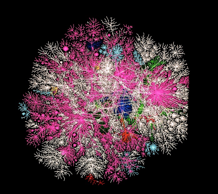
Internet traffic. Computer graphic of global internet traffic. Each line represents the path of sample data sent out to one of 20,000 pre- selected locations using a system called Skitter. The lines are colour-coded to show the nationality of that part of the internet, for example: USA (pink), UK (dark blue), Italy (light blue), Sweden (light green) and white (unknown). The internet is a global computer network through which information can be shared. Maps like this will make moving around the internet easier, as well as showing when and where data jams occur. Made by the Cooperative Association for Internet Data Analysis, University of California, USA.
| px | px | dpi | = | cm | x | cm | = | MB |
Details
Creative#:
TOP10231016
Source:
達志影像
Authorization Type:
RM
Release Information:
須由TPG 完整授權
Model Release:
N/A
Property Release:
N/A
Right to Privacy:
No
Same folder images:
 Loading