
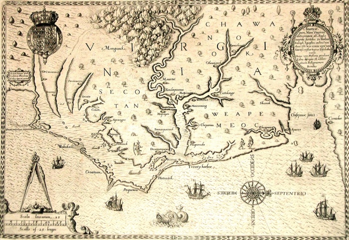
Map of 1590 engraved by Theodore de Bry after watercolour by the English colonist John White, governor of Roanoke. Virginia and coast with small islands and Roanoke at mouth of river. Secotan and Weapemeoc native lands.
| px | px | dpi | = | cm | x | cm | = | MB |
Details
Creative#:
TOP09162649
Source:
達志影像
Authorization Type:
RM
Release Information:
須由TPG 完整授權
Model Release:
NO
Property Release:
NO
Right to Privacy:
No
Same folder images:
 Loading