
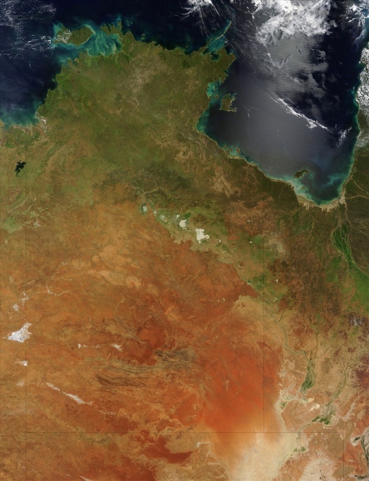
satellite view over Northern Australia, shows the northern portion of the Northern Territory, sometimes known as the Top End. There are also a few large islands visible, including Melville and Bathurst Islands to the north and the smaller Groote Eylandt to the east. The Timor Sea is to the west, with the Arafura Sea to the north, and the Gulf of Carpentaria to the east.
| px | px | dpi | = | cm | x | cm | = | MB |
Details
Creative#:
TOP09095114
Source:
達志影像
Authorization Type:
RM
Release Information:
須由TPG 完整授權
Model Release:
NO
Property Release:
NO
Right to Privacy:
No
Same folder images:
 Loading