
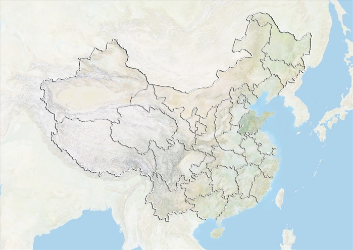
Relief map of China showing the province of Shandong. This image was compiled from data acquired by LANDSAT 5 & 7 satellites combined with elevation data.
| px | px | dpi | = | cm | x | cm | = | MB |
Details
Creative#:
TOP09065188
Source:
達志影像
Authorization Type:
RM
Release Information:
須由TPG 完整授權
Model Release:
NO
Property Release:
NO
Right to Privacy:
No
Same folder images:
 Loading