
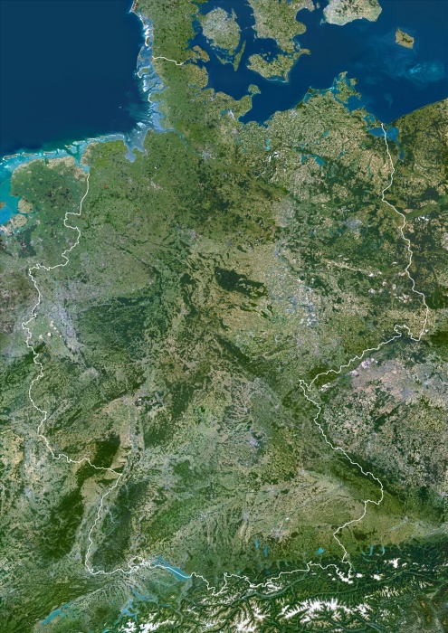
Germany, True Colour Satellite Image With Border. Germany, true colour satellite image with border. This is the largest country in Europe in terms of population, at around 82 million (2006). To its north it borders the Jutland peninsula, which is part of Denmark. East of this is the Baltic Sea, west of it the North Sea. At centre left is the Netherlands, and below that Belgium and France. To its east are Poland (centre right) and the Czech Republic (lower right). The snow-capped Alps mountains (across bottom) lie on the borders with Switzerland (left) and Austria (right). The image used data from LANDSAT 5 & 7 satellites.
| px | px | dpi | = | cm | x | cm | = | MB |
Details
Creative#:
TOP09062897
Source:
達志影像
Authorization Type:
RM
Release Information:
須由TPG 完整授權
Model Release:
NO
Property Release:
NO
Right to Privacy:
No
Same folder images:
 Loading