
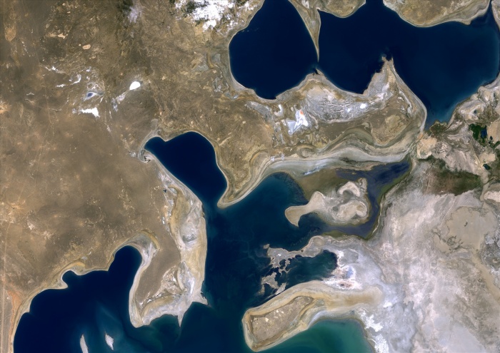
Aral Sea, Kazakhstan & Uzbekistan, 2000, True Colour Satellite Image. Aral Sea in 2000, it lies between Kazakhstan in the north and Uzbekistan, in the south. It has dried up of 60% since the 60's. Image taken on 29 July 2000 using LANDSAT data.
| px | px | dpi | = | cm | x | cm | = | MB |
Details
Creative#:
TOP09061931
Source:
達志影像
Authorization Type:
RM
Release Information:
須由TPG 完整授權
Model Release:
NO
Property Release:
NO
Right to Privacy:
No
Same folder images:
 Loading