
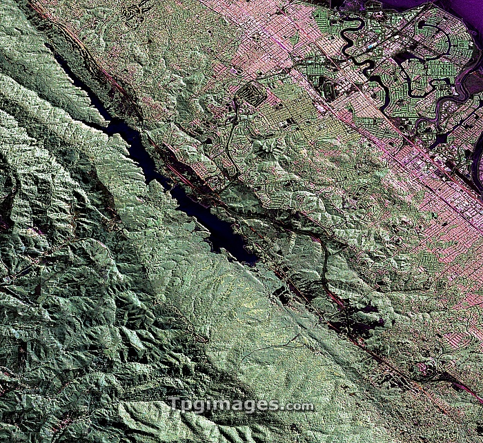
San Andreas Fault. North is at top. Coloured aerial radar image of the region of the San Andreas fault west of San Mateo (pink, upper right), California, USA. The fault line runs from lower right to upper left, through the Crystal Springs Reservoir (black, upper left). This major fault line is the active tectonic boundary between the North American and Pacific tectonic plates, and causes major earthquakes in the region. Foster City is at top right. This image, some 15 kilometres across, was obtained from a Gulfstream-III aircraft by the Uninhabited Aerial Vehicle Synthetic Aperture Radar (UAVSAR) program. Image published in 2009.
| px | px | dpi | = | cm | x | cm | = | MB |
Details
Creative#:
TOP07420749
Source:
達志影像
Authorization Type:
RM
Release Information:
須由TPG 完整授權
Model Release:
NO
Property Release:
NO
Right to Privacy:
No
Same folder images:
 Loading