
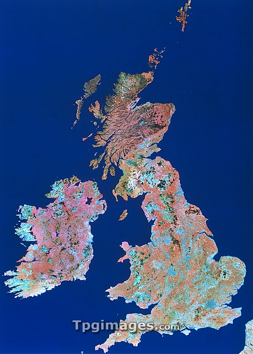
The British Isles seen from space. This is a mosaic of 52 false-colour images made by the Landsat satellites in 1985. The colours represent different surface cover: reds indicate pasture, orange/brown shows arable land, blue/grey indicates urban areas. Light blue indicates coastal sands and silts. Scotland is dominated by dark olive green, denoting mixed moorland and extensive coniferous forest cover. Pale blue/green indicates moist vegetative cover and alkaline soils, seen especially in granitic formations in Wales, the Lake District and the west coast of Ireland.
| px | px | dpi | = | cm | x | cm | = | MB |
Details
Creative#:
TOP06673904
Source:
達志影像
Authorization Type:
RM
Release Information:
須由TPG 完整授權
Model Release:
NO
Property Release:
NO
Right to Privacy:
No
Same folder images:
 Loading