
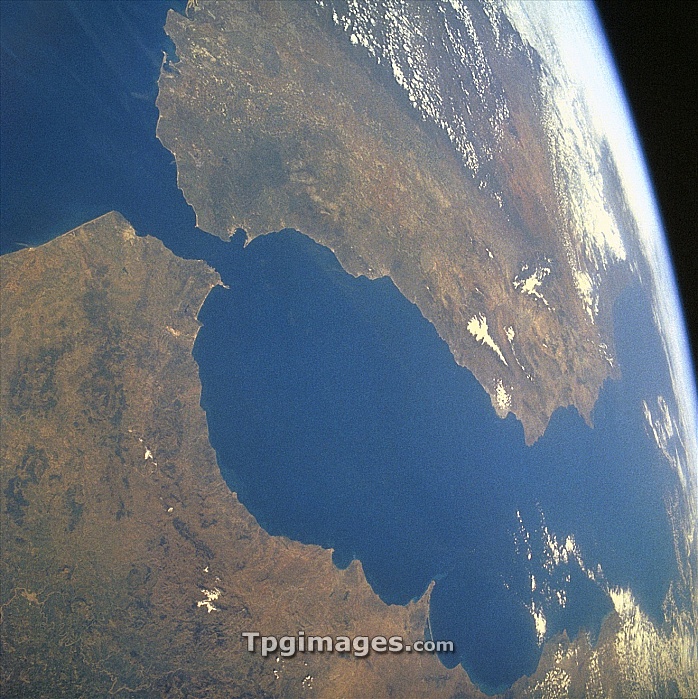
Strait of Gibraltar, satellite image. North is at top, land is brown and water is blue. The Strait of Gibraltar (narrow, blue, upper left) separates Spain (top) from Africa (bottom), and joins the Mediterranean Sea (centre) to the Atlantic Ocean (upper left). It runs between the southern tip of Gibraltar and northern tip of Tangiers, Morocco. It was known as the Pillars of Hercules in the ancient world.
| px | px | dpi | = | cm | x | cm | = | MB |
Details
Creative#:
TOP06672945
Source:
達志影像
Authorization Type:
RM
Release Information:
須由TPG 完整授權
Model Release:
NO
Property Release:
NO
Right to Privacy:
No
Same folder images:
gibraltarspainafricaoceanseaafricacityeuropecoastearthobservationgeographysatelliteimagefromspacesatelliteafricanalgecirasbayatlanticoceanbayofalgecirasbritishoverseasterritorycoastalcoastlineeuropeangeographicalmedmediterraneanmediterraneanseamoroccanmoroccopillarsofherculesrockofgibraltarspanishstraitofgibraltarstraitsofgibraltartangierswaterlandmasslandglobecurvatureoftheearth"
"africaafricaafricanalgecirasalgecirasatlanticbaybaybritishcitycoastcoastalcoastlinecurvatureeartheartheuropeeuropeanfromgeographicalgeographygibraltargibraltargibraltargibraltarglobeherculesimagelandlandmassmedmediterraneanmediterraneanmoroccanmoroccoobservationoceanoceanofofofofofofoverseaspillarsrocksatellitesatelliteseaseaspacespainspanishstraitstraitstangiersterritorythewater
 Loading