
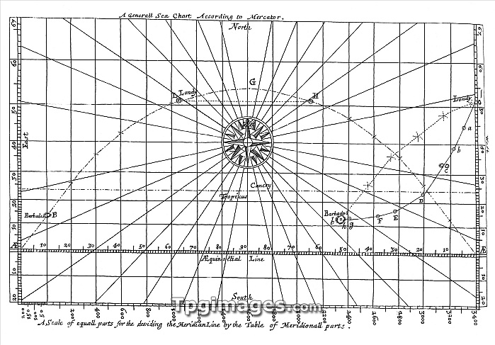
17th century sea chart for a voyage from Londy to Barbados. This shows the Rhumb line (following the same azimuth, right) and the Great Circle (shortest distance across a globe, left). Image from \Mariners Magazine\" Samuel Sturmy (1669)."
| px | px | dpi | = | cm | x | cm | = | MB |
Details
Creative#:
TOP06669166
Source:
達志影像
Authorization Type:
RM
Release Information:
須由TPG 完整授權
Model Release:
NO
Property Release:
NO
Right to Privacy:
No
Same folder images:
 Loading