
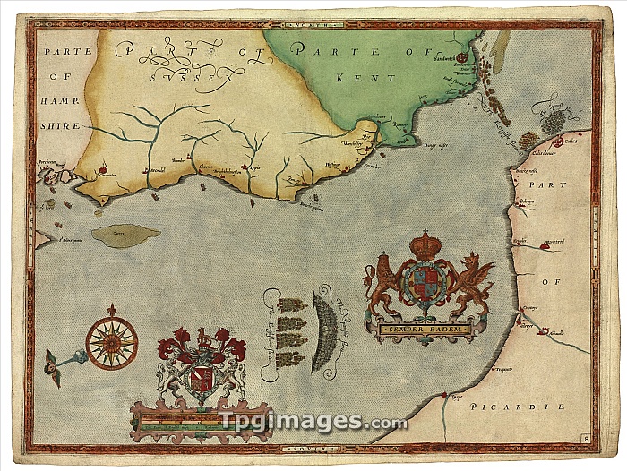
Spanish Armada, pursuit to Calais. Eighth in a sequence of narrative maps showing the story of the Spanish Armada, an attempted invasion of England by a Spanish fleet in 1588. This map covers 4-6 August. First (lower centre), the English fleet (four squadrons) pursues the much larger Spanish fleet (arc), which then anchors off Calais (upper right) to transport troops across the Channel. This series of eleven maps was drawn by Robert Adams, engraved by Augustine Ryther, and published in London in 1590. They were dedicated to the English admiral Lord Howard, who described the events shown, and they include both his coat of arms and those of Queen Elizabeth I. The prevailing wind direction is shown next to the compass rose.
| px | px | dpi | = | cm | x | cm | = | MB |
Details
Creative#:
TOP06666079
Source:
達志影像
Authorization Type:
RM
Release Information:
須由TPG 完整授權
Model Release:
NO
Property Release:
NO
Right to Privacy:
No
Same folder images:
 Loading