
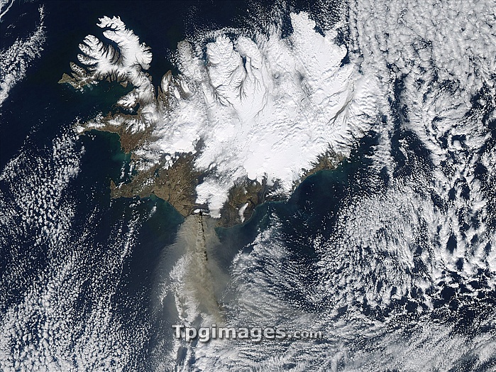
Eyjafjallajokull eruption. Satellite image of the ash plume (grey, lower left) from the April 2010 Eyjafjallajokull eruption. The whole of Iceland (top) is shown, with North at top. Cloud and snow and ice are white. The volcano erupted below the Eyjafjallajokull glacier in southern Iceland on 14 April, sending ash high into the atmosphere. The ash was then blown south and east by the wind over the following days, leading to the airspace over the UK and other northern European countries being shut down due to the hazard the ash posed to aircraft engines. This image was obtained at 13:20 UTC on 17 April 2010, by NASA's Aqua satellite.
| px | px | dpi | = | cm | x | cm | = | MB |
Details
Creative#:
TOP06664732
Source:
達志影像
Authorization Type:
RM
Release Information:
須由TPG 完整授權
Model Release:
NO
Property Release:
NO
Right to Privacy:
No
Same folder images:
 Loading