
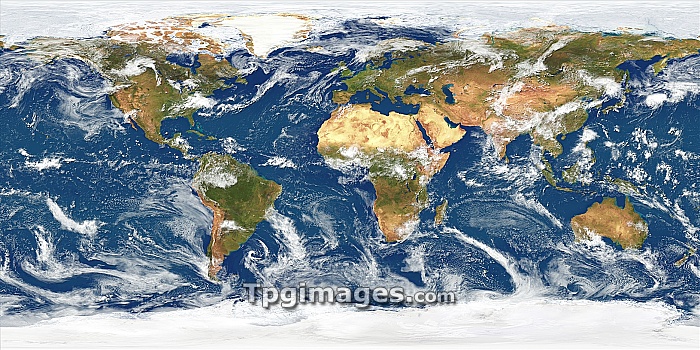
World weather, satellite image. This global map combines data from four satellite systems to show the Earth with typical cloud cover. The cloud images were taken by the MODIS instrument on NASA's Terra satellite on two days (one during the northern hemisphere summer and one during the southern hemisphere summer). The Earth's land surface is shown by thousands of images taken over a two-year period by the AVHRR instrument on NOAA's Polar Orbiter weather satellites. Sea data is from the CZCS instrument on NASA's Nimbus 7 satellite, showing variations in ocean colour. Polar sea ice is shown by the OLS camera on the US Air Force's DMSP satellite.
| px | px | dpi | = | cm | x | cm | = | MB |
Details
Creative#:
TOP06664495
Source:
達志影像
Authorization Type:
RM
Release Information:
須由TPG 完整授權
Model Release:
NO
Property Release:
NO
Right to Privacy:
No
Same folder images:
 Loading