
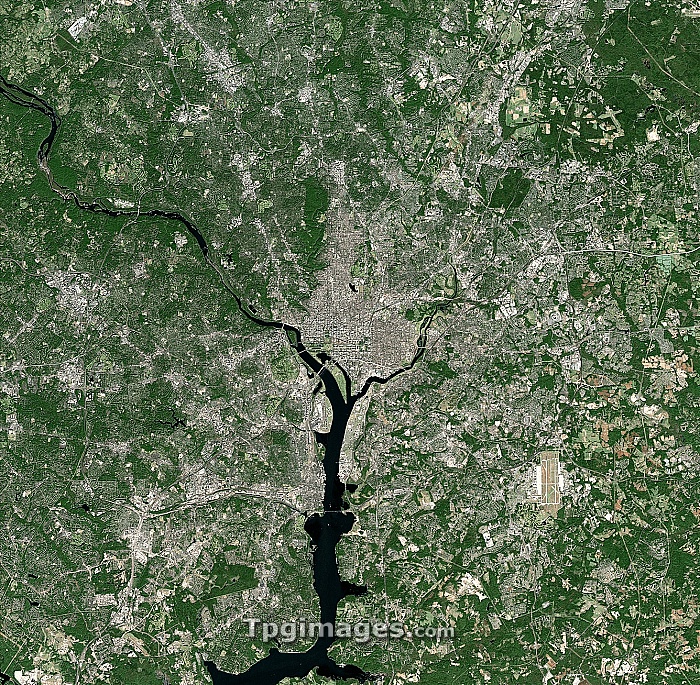
Washington DC, USA. Satellite image of the city of Washington DC, the capital of the US. North is at top. Washington DC is officially named the District of Columbia and is located on the north bank of the Potomac River. It is bordered by the states of Virginia and Maryland. Forested areas are dark green, bare ground is brown, urban areas are grey, and water is black. Image created using NaturalVue data obtained from the Landsat 7 satellite.
| px | px | dpi | = | cm | x | cm | = | MB |
Details
Creative#:
TOP06658633
Source:
達志影像
Authorization Type:
RM
Release Information:
須由TPG 完整授權
Model Release:
NO
Property Release:
NO
Right to Privacy:
No
Same folder images:
washingtondcusacitynorthamericausaearthobservationgeographysatelliteimagefromspacesatellitelandsat7americancapitald.cd.c.districtofcolumbiaforestforestsgeographicalmetropolitannasanaturalcolournaturalvuepatapscoriverpotomacriverriverunitedstatesurbanurbanisationurbanizationusvegetationwaterwoodlandwoods"
"7americaamericancapitalcitycolourcolumbiad.cd.c.dcdistrictearthforestforestsfromgeographicalgeographyimagelandsatmetropolitannasanaturalnaturalvuenorthobservationofpatapscopotomacriverriverriversatellitesatellitespacestatesunitedurbanurbanisationurbanizationususausavegetationwashingtonwaterwoodlandwoods
 Loading