
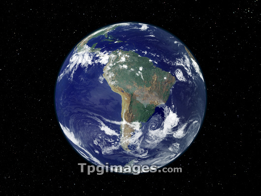
South America. Satellite image of the Earth, set against a background of stars, centred on the continent of South America. North is at top. Clouds (white) are seen in the atmosphere. On the surface, seas and oceans (blue) surround the land. Land cover ranges from vegetation such as forests and grassy plains (green) to arid areas such as deserts, mountains, and scrublands (brown). South America is dominated by the Amazon rainforest in the north, central mountains, the Andes mountains along the western coast, and plains, swamps and glaciers in the south. This image, from 2001, combines data from a variety of satellite sensors (AVHRR, SeaWiFS, MODIS) at a range of wavelengths.
| px | px | dpi | = | cm | x | cm | = | MB |
Details
Creative#:
TOP03206329
Source:
達志影像
Authorization Type:
RM
Release Information:
須由TPG 完整授權
Model Release:
N/A
Property Release:
N/A
Right to Privacy:
No
Same folder images:
 Loading