
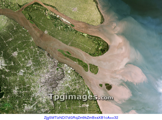
Shanghai and the Yangtze, 2001. Image one of one. Shanghai, visible as a purple grey conurbation towards bottom left, is one of the largest cities in the world, with a population of around 20 million. The Yangtze river drains much of China, carrying sediment and silt over 6000 kilometers from the remote, westerly, highland regions of China until it reaches the East China Sea, just above Shanghai. During the 1990s, Shanghai was declared a Special Economic Development Zone and saw huge investment and development. The effects on the environment are visible when comparing a satellite image from 1989 (see image E780/1232). There has been a loss of green vegetation (green) and an increase in sediment deposition at the river's mouth. Photographed by NASA's Landsat 7 satellite.
| px | px | dpi | = | cm | x | cm | = | MB |
Details
Creative#:
TOP01491476
Source:
達志影像
Authorization Type:
RM
Release Information:
須由TPG 完整授權
Model Release:
N/A
Property Release:
N/A
Right to Privacy:
No
Same folder images:
 Loading