
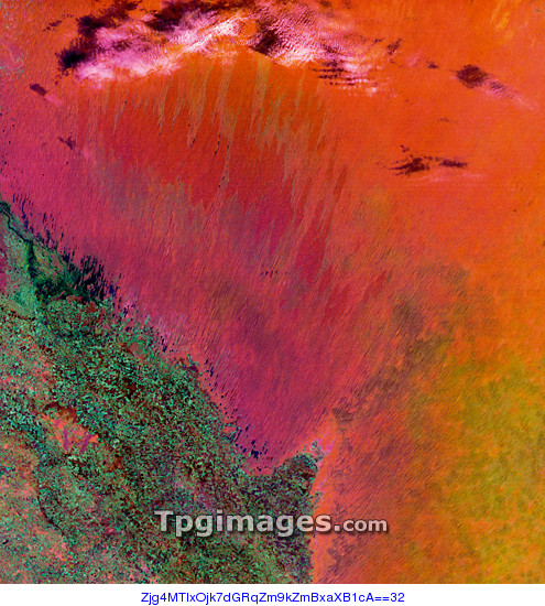
Agriculture and desert, Pakistan, satellite image. North is at top. Desert sands (orange, main image) contrast with agricultural fields (green, lower left). Water (dark blue) in the fields, and in the lakes along the desert-fields border, comes from the Mithrani Canal system that brings water from the Indus River to the north and west. Clouds (white, across top) are casting their shadows on the sands, which form part of the Thar Desert. The Pakistan-India border runs down far right. This area lies north-east of the city of Mirpur Khas, Pakistan. This 180-kilometre-wide image was taken on 7 March 1973 by NASA's Landsat 1 satellite.
| px | px | dpi | = | cm | x | cm | = | MB |
Details
Creative#:
TOP01490950
Source:
達志影像
Authorization Type:
RM
Release Information:
須由TPG 完整授權
Model Release:
N/A
Property Release:
N/A
Right to Privacy:
No
Same folder images:
 Loading